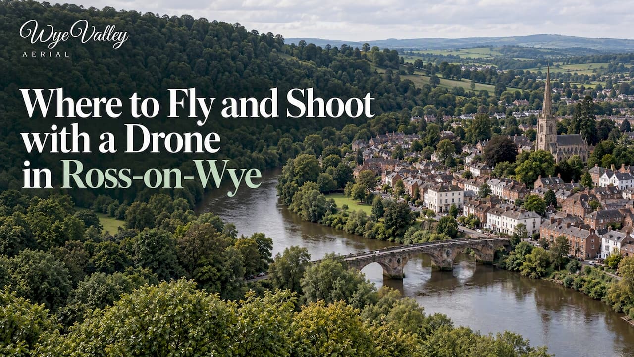
The best drone photo subjects around Ross-on-Wye are the river and the landmarks above it: Goodrich Castle, the Symonds Yat gorge, the quiet Sellack Suspension Bridge and the wooded Forest of Dean beyond. The catch is that the best-known sites are not always places you can launch from. This guide covers what each spot offers from the air, which ones restrict drones, and the CAA rules that apply wherever you fly.
TL;DR
- Top subjects: Goodrich Castle, Symonds Yat Rock and the Wye gorge, Sellack Suspension Bridge, and the river meadows around Lea and Ross itself.
- English Heritage does not allow recreational take-off or landing on its sites, and Cadw's policy in Wales is the same, so Goodrich is a view to plan, not a launch point.
- Any drone of 100g or more with a camera needs an Operator ID, and its pilot needs a Flyer ID, whatever the location.
- Landowner permission and local byelaws matter as much as the CAA rules, so check who owns the ground you will launch from.
- For paid work such as sales photos, weddings, hotels or roof checks, use a qualified commercial pilot.
Table of Contents
- What makes Ross-on-Wye good for aerial photography
- Goodrich Castle and the Lea side of the valley
- Symonds Yat Rock and the Wye gorge
- Sellack Suspension Bridge
- Around Ross-on-Wye itself
- Further afield: Biblins, Redbrook and the Forest of Dean
- Spots at a glance
- UK rules to follow at every spot
- When the shoot is paid work
- Our perspective
- Need the shots without the planning?
- FAQ
- Sources
What makes Ross-on-Wye good for aerial photography
Ross sits on a tight loop of the River Wye, with red sandstone, steep wooded banks and small fields running down to the water. That mix gives you strong lines, layered colour and reflections without the need for a high altitude. Most of the best frames are taken low, often well under the 120m maximum height in the UK Drone Code, where the river bend, a tower or a bridge reads clearly against the landscape.
The area also changes through the year. Autumn mist in the valley, spring blossom around the orchards and winter low sun all give different results from the same position. If you are planning a specific shoot, our guide to light, season and weather for aerial photos explains how to pick your window.
Below, the spots are ordered roughly from the most photogenic to the most practical. For each one: what you can capture, and what to check before the drone leaves the case.
Goodrich Castle and the Lea side of the valley
Goodrich Castle is the obvious headline subject. English Heritage describes it as a medieval castle founded in the late 11th century, and it stands on a rock above the Wye with a commanding position over the valley. From a distance, with the red stone against green fields, it is one of the most photogenic structures in the county.

The rules matter here. English Heritage does not allow recreational drone take-off or landing on its sites, citing limited staffing and its duty to protect visitors and historic fabric. The same page says pilots who follow the UK Drone Code may choose to fly over its sites outside no-fly zones, but English Heritage strongly urges them not to. Treat that as a clear steer: do not launch from the castle grounds, and do not fly over visitors.
The practical alternative is to compose the castle from a legal launch point elsewhere, using public land where flying is permitted and the landowner agrees, and keeping the aircraft well away from people. The village of Lea, nearby, and the fields and lanes around Goodrich are the sort of areas to scout, but each launch site belongs to someone. Ask first. If you are photographing the castle as part of a commercial job, such as promotional material for a nearby holiday let, contact English Heritage before you plan anything, rather than assuming a commercial licence covers its land.
Opening hours for visitors are generally 10am to 4pm or 5pm depending on the season, according to English Heritage's opening times page. Check that page for the current schedule before a visit.
Symonds Yat Rock and the Wye gorge
Symonds Yat is the dramatic one. Forestry England describes Symonds Yat Rock as a historic site in the Forest of Dean with an ancient hill fort, peregrine falcon birdwatching and walking trails. From above, the river makes a tight loop through a wooded gorge, which is the image most people want to capture.
Two cautions apply:
- Wildlife. The peregrine falcons that draw birdwatchers to the rock are the reason to be careful with a drone. Birds of prey nest on the cliffs in spring and early summer, and an aircraft near a nest can disturb them and may be an offence. Keep well clear of the cliff faces in that season, and ask Forestry England if you are unsure.
- Crowds and land. The viewpoint is busy, especially on dry weekends. The Drone Code asks you to keep your drone away from uninvolved people, and a popular viewpoint is a poor place to take off. Forestry England manages the rock, so check its guidance on drones before planning anything beyond a casual flight.
Parking is the other practical point. Forestry England lists charges at Symonds Yat Rock from £2.50 for an early bird exit before 10:30am to £8.00 for all-day parking, with no charge for car-free visitors. Prices can change, so confirm on the day. An early arrival also gives you softer light and fewer people in the frame.
The Wye here marks the edge of England and Wales. Across the border in Monmouthshire, different landowners and authorities apply. If your route takes you onto Cadw property, such as a scheduled monument, Cadw does not permit recreational drone take-off or landing. Commercial operations there need a formal application, public liability insurance of at least £5 million, a method statement and risk assessments, as the same policy sets out.
Sellack Suspension Bridge
For something less obvious, look at Sellack. The Hereford Times has published aerial photographs of Sellack Suspension Bridge, a little-known River Wye crossing about four miles northwest of Ross-on-Wye. A slender footbridge over a wide, slow river is a good aerial subject because the geometry is clean: the bridge line, the river's curve and the fields on both banks.

This kind of spot rewards a patient approach. Fly low and slow along the river, use the bridge as a leading line, and shoot at either end of the day when the water is calm. Because it is a quiet crossing, you are less likely to have people in the shot, but you still need to check who owns the bank you launch from and keep the aircraft in sight at all times.
Around Ross-on-Wye itself
Ross has its own strengths: the town perched above the river, the church spire, and the curve of the Wye below the Prospect. The challenge is that a built-up town leaves few legal places to launch, and flying over streets and gardens is where most pilots get into trouble. Before you fly anywhere near houses or people, read our summary of what the law says about drone filming over private property. Taking a photograph is rarely the issue; the problems are privacy, data protection and flying over people who have not agreed to it.
The river meadows on the edge of town are easier. Open ground with few people and a clear view of the river gives you the town's skyline from a distance, and it is often the safest way to show Ross in its setting. Always get the landowner's agreement, and be aware that local council byelaws in Herefordshire, the Forest of Dean and Monmouthshire may restrict launching from public spaces such as parks.
Further afield: Biblins, Redbrook and the Forest of Dean
If the main sites are restricted or too crowded, the wider Wye Valley has alternatives. Some stretches around Biblins and Redbrook have public footpath access, which can serve as launch areas, but footpath access is not permission to launch and land ownership should be checked before you rely on one. Public rights of way are about walking, not flying.
The Forest of Dean offers a different look: dense woodland, forest tracks and ponds. Forestry England lists Beechenhurst, with its Sculpture Trail, the Forest of Dean Cycle Centre, Mallards Pike and Cannop Ponds as visitor sites. Water and tree canopy make for strong autumn colour from the air. Parking at Beechenhurst, according to Forestry England, runs from £2.50 for an early bird exit to £9.00 for all-day parking. As these are Forestry England sites, check its drone rules before you fly, and watch for walkers, cyclists and wildlife.
Spots at a glance
| Spot | What you can capture | Main restriction to check |
|---|---|---|
| Goodrich Castle | Medieval castle above the Wye, valley views | English Heritage does not allow take-off or landing on its sites |
| Symonds Yat Rock | River loop in a wooded gorge | Nesting peregrines, crowds, Forestry England land |
| Sellack Suspension Bridge | Footbridge and river bend | Landowner permission for launch point |
| Ross-on-Wye and river meadows | Town skyline in its river setting | Privacy, people, council byelaws |
| Biblins and Redbrook | Wooded river banks | Footpath is not permission to launch |
| Forest of Dean (Beechenhurst, Cannop Ponds) | Canopy, ponds, autumn colour | Forestry England rules, walkers and cyclists |
UK rules to follow at every spot
Wherever you fly, the legal baseline is the CAA's Drone Code. The March 2026 edition of the Drone and Model Aircraft Code sets out the essentials: keep the drone in visual line of sight, follow the weight-based registration rules, and respect the distance requirements of your sub-category.
In practice, that means three checks:
- Flyer ID. A Flyer ID is required for anyone flying a drone or model aircraft weighing 100g or more, whether or not it has a camera.
- Operator ID. On the same CAA page, an Operator ID is required if the aircraft weighs 250g or more, or 100g or more and carries a camera. Almost every photography drone falls into this group. The ID must be displayed on the aircraft.
- Distance from people. The sub-category you operate in decides how close you may fly to uninvolved people. The A2 Certificate of Competency is what allows operation in the Near People (A2) sub-category. If you want to know what that means on a real job, read our explainer on the A2 CofC and the 30m and 5m rules.
Also check airspace before every flight, using an official airspace map or a drone app that shows restrictions. The Wye Valley is largely rural, but you should never assume a location is clear. Add weather: wind funnels along the gorge and can be stronger at the rim than at the car park.
A simple pre-flight routine
- Identify the landowner and get permission to launch and land.
- Check for English Heritage, Cadw, Forestry England or other site policies.
- Check airspace and any temporary restrictions.
- Walk the site for people, livestock, power lines and trees.
- Look up wildlife constraints for the season, especially near cliffs and water.
- Fly within visual line of sight and keep the aircraft away from uninvolved people.
When the shoot is paid work
A hobby flight and a commercial job are different things, and the difference shows up fast at the locations above. Heritage and conservation bodies want formal applications, insurance and risk paperwork for commercial flying. Cadw, for example, asks for at least £5 million of public liability insurance, a method statement and risk assessments before a commercial operator can take off or land on its property.
If you are commissioning aerial work around Ross, a few checks save time:
- Selling a home or letting a property. Aerial stills show the plot, the boundaries and the setting in ways ground photos cannot. Make sure neighbours' gardens are not the focus of the images, and see our guide to commercial drone photography deliverables, rules and briefing.
- Weddings. Guests are the issue. Distance from people drives what shots are possible, so read about the 50 metre rule for wedding drone video before you book.
- Hotels and estates. A venue needs a flight policy, including who approves flights and what insurance is expected. Our three checks before approving a hotel drone flight cover it.
- Roofs and buildings. A drone can check a chimney, ridge or valley without ladders. For paid inspection work, see the qualifications UK pilots need for roof jobs.
If you are comparing methods, mast photography versus drone is worth a read, and the costs behind a quote are explained in our piece on drone photography prices in the UK.
Our perspective
Most of the trouble we see around Ross is not about flying skill. It is about the five minutes before the flight. Who owns the field, does the site have a drone policy, are there people nearby, and what is the wind doing in the gorge?
That is why we plan every job around the site and the shot list first. We fly as a qualified pilot with A2 CofC certification and full insurance, we follow flight plans and CAA rules strictly, and we build the shoot around what you need, whether that is a listing, a wedding, a hotel promotion or a roof check.
We also reschedule flexibly when the weather is wrong, because a flight in poor light or high wind gives you worse pictures and no one benefits from that. The best aerial shot of this valley is the one taken legally, at the right time of day, with the landowner's agreement.
Rhys
Need the shots without the planning?
If you want aerial images of a property, venue or roof in the Wye Valley but do not want to sort out permissions yourself, we handle the planning, flying and editing. Our services include property stills, stills with a short film, half-day and full-day shoots on site, and roof and building checks. Each job is quoted individually, and we provide free fixed quotes in advance.

See what we offer on our services page, or get in touch through our main site with your location and what you need to capture. Finished stills or films are delivered by download link.
FAQ
Can I fly a drone at Goodrich Castle?
Not from the grounds as a recreational pilot. English Heritage does not allow recreational take-off or landing on its sites. It says pilots following the UK Drone Code may fly over its sites outside no-fly zones, but it strongly urges them not to. For commercial work, contact English Heritage first.
Do I need to register my drone to take photos around Ross-on-Wye?
In most cases, yes. The CAA requires an Operator ID for a drone weighing 100g or more with a camera, and a Flyer ID for the pilot of anything 100g or more. The rules apply across the UK, including Herefordshire and the Forest of Dean.
Is Symonds Yat a good place to fly a drone?
It is a superb subject, but it is a busy site with nesting peregrine falcons on the cliffs. Keep well away from the rock faces in spring and early summer, avoid flying near crowds, and check Forestry England's guidance before you plan a flight.
Does a public footpath mean I can launch my drone there?
No. A footpath gives you the right to walk, not to take off and land. You still need the landowner's agreement, and local byelaws may restrict launches from some public spaces. Check who owns the land before you rely on a path.
Can I hire someone to photograph my property from the air in Ross-on-Wye?
Yes. Look for a pilot who holds the right CAA qualifications, carries insurance, and quotes a fixed price against a clear shot list. We cover Ross-on-Wye, Monmouth, Chepstow, Coleford and Lydney.
Sources
- Goodrich Castle, English Heritage
- Prices and opening times for Goodrich Castle, English Heritage
- Drone guidance, English Heritage
- Symonds Yat Rock, Forestry England
- Beechenhurst, Forestry England
- Cadw drone policy
- Bird's-eye views of Herefordshire suspension bridge, Hereford Times
- The Drone and Model Aircraft Code, March 2026, CAA
- Getting what you need to fly legally, CAA
- Introduction to more advanced flying, CAA